Tuesday, July 31, 2012

Archbold Biological Station and Private Preserve


Archbold Biological Station, established in 1941, is a not-for-profit independent research institution in central Florida. The Station is dedicated to long-term ecological research, part of the global effort to understand, interpret and preserve the world’s natural heritage. 

Staff, visiting investigators, and students conduct research primarily focused on the organisms and environments of Lake Wales Ridge and adjacent central Florida. Archbold is used heavily for education including research training for graduates and undergraduates from around the world, use by visiting college classes, extensive K-12 education, and public outreach.

Archbold Biological Station and the Archbold Reserve together comprise an 8,840-acre globally significant preserve and one of the most distinctive natural habitats in the United States. The Station is a series of relict sandy dunes, including xeromorphic scrubs, flatwoods and the 90-acre Lake Annie. Neighboring state-owned lands and private conservation easements mean that the Station lies within a protected area network totaling 16,200 acres. 

This region supports many of the rarest species in North America. Archbold is host to 19 federally listed species and is regarded as critical for the long-term global viability of numerous endemic scrub species. The Archbold Collection with over 230,000 biological specimens of plant, arthropod, bird, mammal, herptile and fish is an important regional collection emphasizing species from the scrub habitats of the Station and the Lake Wales Ridge. 

Richard Archbold, the colorful aviator-explorer, founded the Station in 1941. After more than a decade of exploration in Madagascar and New Guinea, Archbold obtained the original 1,000-acre "Red Hill" Estate as a gift from John A. Roebling, II, grandson of the Brooklyn Bridge designer. Early research was dominated by botanical and entomological explorations, and many scientists developed long-term projects that became milestones in their fields.

 The Station grew substantially during the 1970s and 80s, adding important new property and other vital research equipment. In 1986, with National Science Foundation support, an Annex was added to the Main Building to house research collections, lab and computer space, and an auditorium.

Visitors are welcome, although visitor facilities are somewhat limited.  All visitors should register at the Main Office  M-F 8-5, Weekend visitors should register at the Information kiosk at the north end of the Plaza.  Pictorial exhibits about the Station and its history are in the Auditorium, available M-F 8-5.

"Islands in Time," a 19-minute video about the biodiversity and conservation of the Lake Wales Ridge, is available in the Lounge adjacent to the Main Office, M-F  from 8-5. A half-mile Nature Trail, emphasizes plant identification and scrub ecology. Picnic tables are at the north end of the Plaza. Pets are not permitted.   
Archbold Biological Station 123 Main Dr. Venus, Fl, 33960

Friday, July 27, 2012

Bald Cypress not bald pond bottoms

 MAKE SURE YOU READ THE REPLY'S UNDER THE ORIGINAL MESSAGE!

Dear State Forester
I look at the retention ponds along the Suncoast Parkway and wonder why they look like a golf course or front lawn. There must be a hundred thousand acres of land in those normally dry treatment and detention areas, and along the low linear ditches that run from Tampa to Crystal River. I’m not looking at the medians and the safety areas next to the road, I understand they need to be clear for vehicles that leave the pavement.  But the far side of the ditches, and the areas in the detention areas behind raised dykes and levies…are far beyond anywhere a car could get- even airborne.

Now, why aren’t there trees in there? Water tolerant trees like Pond Cypress and Bald Cypress? Instead of mowing the areas, we could plant a giant Cypress Strand from Tampa to the Nature Coast. Cypress trees, that can stand and grow in water. Cypress trees that can sequester carbon, absorb and convert other vehicle origin pollutants into seeds and trees.

The State Forest Service must have a nursery for trees. Dozens of nature groups would love to help plant them.  The Audubon Society and Arbor Day foundation would be so proud, and might help with trees and costs.  Planting a few in each retention area this next dry season, and in 10 years….if that is all we do, the trees will seed the rest of the area.  No more mowing, no more bare ground along the parkway that thousands take to spend eco-dollars in the Nature Coast businesses.

And while we are at it, our water quality board SWFTMD could suggest every business in their district do the same thing- Turn ugly unused space into a Cypress mini-dome. (Not change the rules to require it, but educate and encourage it!)  Maybe the Cities that need somewhere to plant mitigation trees for those cut down, can turn to retention ponds and Cypress trees. If the State Forester gets behind this, and the State Nursery gives trees at cost, cypress trees can absorb noise, make shade, hide blighted areas from view, and help our backyard wildlife.

If the DOT gets on board, many of the dry ponds along our Interstates can also be cypress forests, half an acre at a time. Double duty for our drainage and treatment ponds, and green to boot!

REPLY NUMBER ONE///////


On behalf of the State Forester, Mr. James Karels, I am responding to your e-mail correspondence dated July 22, 2012, where you are providing suggestions/ideas to utilize certain open space areas (retention ponds) of various state road thoroughfares by planting cypress trees.

First of all we at the Florida Forest Service (FFS) do encourage and assist other state agencies with tree planting projects across the state through our Cooperative Forestry Assistance/Rural & Urban and Community Forestry program’s. Many cities, municipalities, and rural communities have benefited from numerous grant opportunities that we administer to plant trees in open underutilized spaces.  Tree canopy in both the rural and urban setting  is very important for many reasons (some you have mentioned) such as carbon sequestration, air purification, aesthetics, buffering the impact of storms, reduces costs of maintenance, forest production, supports wildlife food and shelter needs, etc…. . The Florida Forest Service is committed to make our “rural & urban forests” of the state attractive and productive.

Additionally the FFS works very closely with other state agencies (such as the Florida Department of Transportation - FLDOT) by providing seedlings or advising where to obtain containerized trees for tree planting projects that are part of their planned projects and ongoing activities, however we cannot speak specifically for these other agencies on how these projects are regulated or governed. To properly address your retention pond suggestion/ideas I believe that it would most appropriate for you to contact the FLDOT Environmental Office to discuss this issue. I suggest that you contact Jeff Caster, the State Landscape Architect, at the FLDOT. Jeff’s e-mail is Jeff.Caster@dot.state.fl.us and his direct line phone number is 850-414-5267.

As I stated before we at the Florida Forest Service are committed to all aspects of forestry and the management thereof in the great state of Florida. I appreciate your suggestion/idea and if it comes to fruition the FFS will be a willing and working partner to make this become a success.

I hope that I have provided enough information here to you to assist with keeping your idea moving forward and If I can be of any further service to you please do not hesitate in contacting me either by phone or by e-mail.

Sincerely,

887274511@28092011-2200Steven L. Jennings
State Lands Supervisor
Florida Forest Service


REPLY NUMBER TWO///////////////////////////////


Thank you for your very thoughtful and informative email about roadside pond landscapes.
Next week, I will be meeting with FDOT Turnpike staff, and can discuss your suggestion.  We are always looking for ways to improve the turnpike system, and minimize the cost of maintenance.
Thank you again.
Jeff

Jeff Caster
State Transportation Landscape Architect
Florida Department of Transportation
Environmental Management Office


Tuesday, July 24, 2012

Yankeetown Hurrah!

I had some conversations with a few Florida County Parks Departments about Boardwalks in parks, and the locations of wilderness preserves or nature parks in their county. Lake County sent me a huge packet of trail information, some of it from statewide programs that were not theirs. They were very encouraging in their response, and sent me the packet priority mail, at nearly $5 expense... Great service!

Another county sent me a note saying they don't have any nature trails, preserves, or boardwalks because (since the creation of the county, I guess) they don't have the funding for such things. The implication I took from the tone of their reply was that they though such things were frivolous. 

The Headwaters of the Withlacoochee River in the Green Swamp, viewed from Pasco County's Withlacoochee River Park.

While taking pictures of the Cross Florida Barge Canal, I drove through the tiny coastal village of Yankee Town. They had a nature center, observation tower, boardwalk and a Preserve. They got creative, search out grants, and built a beautiful public access preserve into the salt marshes where the Withlacoochee River meets the Gulf of Mexico.


At first, I thought it was just a gravel road along a powerline right-of-way. It is, but soon it meanders around some salt ponds, and then I found a boardwalk.

Not bad for a tiny hamlet. Nice open boardwalk with a kick railing. A few spots were recently repaired, so it gets regular maintenance


The boardwalk is less than a mile long. It loops around a Salt Pond and flanks a huge salt marsh that reminds me of a slough. At the end is a tiny marked sink hole in the Karst Limestone.

The land to the southeast of the boardwalk has a few freshwater springs, and the slash pine must be getting enough fresh water that the salt air does not retard them. They are green and growing strong.


The Nature Education Center is huge, and is undergoing renovations.

You can see the mangrove hammock islands in the salt marsh from the trail. You can see the Gulf from the observation tower. The Withlacoochee braids through the marsh as it heads toward the Gulf of Mexico.


"For the last word in procrastination, 
go travel with a river
 reluctant to lose his freedom in the sea."
 -Aldo Leopold A Sand County Almanac


So they got creative with financing, and they built this preserve. I wish every County had at least one. All I can add is....Hurrah! for Yankeetown. Their site doesn't mention the boardwalk, but you can see their site at:

http://yankeetownfl.govoffice2.com/index.asp?Type=B_BASIC&SEC={5D4F5275-C404-4F83-8F1C-5216B4213117}&DE={795643E8-EE9D-4558-B978-312F581791F2}


.


Saturday, July 14, 2012

Book Exerpt from Boardwalks and Long Walks

This is a sample of the site listings in Section 2 of "Boardwalks and Long Walks". Posted by the author. (C)


Big Cypress WMA                                        Collier, Dade, Monroe         Site # 8346

Big Cypress WMA consists of 565,848 acres. The area spans parts of Collier, Dade, and Monroe counties. The name 'Big Cypress' refers to the extent of the area and not to the size of the trees.  In fact many of the trees within the Big Cypress are dwarf pond cypress but areas of pinelands, tropical hardwood hammocks, and freshwater marshes abound. 


 Both temperate and tropical flora and fauna are found throughout Big Cypress.  Here you can find many rare and protected species including the Florida panther and black bear as well as the tropical liguus tree snail, royal palm, and cigar orchid. Recreational opportunities include hunting, fishing, wildlife viewing, paddling, hiking, biking, and camping.  Designated campsites are available at several locations in the WMA. The Oasis Visitor Center is located on US Highway 41 (Tamiami Trail) mid-way between Naples and Miami.   

There are two driving tours, abundant with wildlife, that lead you through open prairies, cypress swamps, hammocks, and pinelands; Turner River Road and Loop Road.  Turner River Road is a dirt road which dead ends approximately 20 miles north of 41 with no access to I-75.  Loop Road has access points at Monroe Station and Forty Mile Bend Check Station and runs south of Highway 41 for 23 miles (15 miles, dirt; eight miles, paved). 

Hiking trails of varying difficulty are located throughout Big Cypress, including 31 miles of the Florida Trail. Bear Island is a great place to ride a bike and the Turner River Canoe Trail winds through a variety of South Florida habitats.  For most, visiting Big Cypress is more pleasant in the winter when bugs are fewer and both temperature and water levels are lower.


For more from the book go to:


Wednesday, July 11, 2012

What's the Dif ? Part two

This is part two, and will make more sense if you read part 1 first...


The following types of parks are not unique to Florida, but are included for comparison.

NATIONAL FOREST

National Forests are areas owned by the federal government and managed by the United States Forest Service, which is part of the United States Department of Agriculture. Land management of these areas focuses on timber harvesting, livestock grazing, water management, wildlife management, and recreation. 

Unlike national parks and other federal lands managed by the National Park Service, commercial use of national forests is permitted, and in many cases encouraged. In the United States there are 158 National Forests containing over 190 million acres of land. These lands comprise almost 9 percent of the total land area of the United States, an area the size of Texas.

NATIONAL PARK

The National Park Service is a bureau of the U.S. Department of the Interior founded in 1916. There are nearly 400 Parks, Monuments, and other places that host more than 275 million visitors every year, and cover 84,000,000 acres of land. The NPS also helps administer dozens of affiliated sites, the National Register of Historic Places, National Heritage Areas, National Wild and Scenic Rivers, National Historic Landmarks, and National Trails.

The fundamental purpose of the NPS “is to conserve the scenery and the natural and historic objects and the wild life therein and to provide for the enjoyment of the same in such manner and by such means as will leave them unimpaired for the enjoyment of future generations.”

Yellowstone National Park was established by Congress as the nation’s (and the world’s) first national park on March 1, 1872. Wrangell-St. Elias National Park and Preserve is the largest unit with 13.2 million acres. 

PRIVATE PRESERVES

Many environmental organizations are taking an active role in wildlife conservation. The five largest national and state land trusts protect over 14 million acres of land in the United States. Land trusts are nonprofit organizations directly involved in protecting environmentally significant lands. These are not public lands per se, but many invite the public to their lands to educate and “infect them with the awe due to nature.”

The Nature Conservancy is the largest private nonprofit conservation organization. With over one million members, it manages the largest system of private sanctuaries in the world, protecting over 70 million acres worldwide. Operation Stronghold, Ducks Unlimited, the Isaac Walton League, Boone and Crocket Club, and the Audubon Society also have preserves and nature centers. There are hundreds of small land trusts and preservation societies across the United States saving wilderness and most invite the public to share their preserves and parks.


Boardwalk FB Page 


Wildlife in Florida Parks, Forests, Preserves.... 

What's the Dif? part 1


Aldo Leopold understood that a great many people must love the public lands in a natural or wilderness state in order to keep the public lands safe from industrial development. He knew that to love wilderness that the great masses must first be exposed to the natural world. They must develop their unique and personal relationship with the outdoors one on one. He also understood that by exposing man to nature, that we were exposing nature to man. He feared that nature might be so ravaged during that oh so necessary encounter that it might not maintain its true identity. 

“The life of every river sings its own song, but in most the song is long since marred by the discords of misuse. Over grazing first mars the plants and then the soil. Rifle, trap, and poison next deplete the larger birds and mammals. Then comes a park or forest with roads and tourists.  Parks are made to bring the music to the many, but by the time many are attuned to hear it, there is little left but noise.” –Aldo Leopold -A Sand County Almanac

The Unique Florida experience begins in public lands. These lands might be managed differently in other States and other countries. Here is a simple description of three of those divisions.

FLORIDA STATE PARKS
The Department of Environmental Protection (DEP) protects, conserves and manages Florida's natural resources and enforces the State's environmental laws. The DEP oversees and manages Florida's award-winning state parks and trails system. Since 1990, through its innovative land acquisition programs - Preservation 2000 and Florida Forever - more than two million acres of valuable lands have been preserved, protecting habitat for 190 native and endangered animals and plants, while restoring ecosystems throughout the state.

Florida's State Parks encompass more than 700,000 acres and attract more than 20 million visitors every year.The largest State Park is Fakahatchee Strand Preserve State Park covering 77,574 acres. The smallest State Park is Fernandina Plaza Historic State Park at less than an acre. The oldest State Park is Olustee Battlefield Historic State Park that was dedicated in 1899. The most visited State Park is Honeymoon Island State Park Northwest of Tampa Bay with 1,134,509 visitors a year.


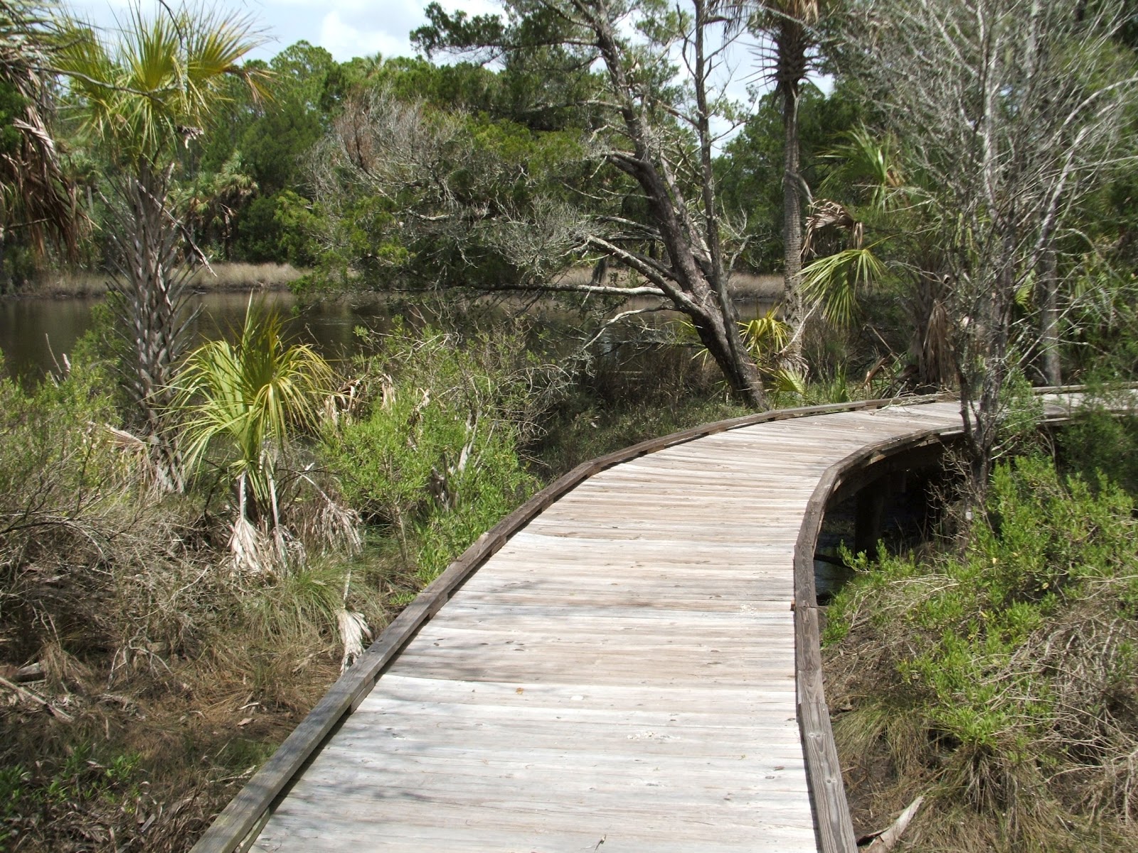
A State Park Virtual Tour 

FLORIDA STATE FORESTS
One of the many missions of the Department of Agriculture and Consumer Services is to safeguard the public and support Florida's agricultural economy by conserving and protecting the state's agricultural and natural resources by reducing wildfires, promoting environmentally safe agricultural practices, and managing public lands. They do this through their State Forest Service.

The Florida Forest Service has guided the operation of state forests for over 75 years. Its primary mission, while managing these lands, is to protect and maintain the biological diversity of the many ecosystems found in and around the state forests while integrating public use of the resources. Through sound forest management practices, the Florida Forest Service is able to maintain the integrity of the forest environment while providing for the state's future natural resource needs. 

There are currently 35 State Forests that total over 1,058,000 acres.Since its humble beginnings in 1936 of one state forest with 6,000 acres, Florida ’s state forest system has grown to include 35 state forests and the management of over one million acres of forest lands. In the late 1970s, Florida began aggressively purchasing land for future generations from which more state forests were created. The focus on land management shifted from simply management of timber and wildlife resources to a multiple land use management ethic which includes conservation of natural and cultural resources, wildlife management, protection of water resources, and outdoor recreation. 

Florida’ Wildlife Management Areas and WEA’s

 Florida's Wildlife Management Area system is managed by the Florida Fish and Wildlife Conservation Commission to sustain the widest possible range of native wildlife in their natural habitats. These lands are more rugged than parks, with fewer developed amenities. This system includes more than 5.8 million acres of land established as WMAs or Wildlife and Environmental Areas. On the majority of these lands , about 4.4 million acres, FWC is a cooperating manager working with other governmental or private landowners to conserve wildlife and provide public use opportunities. On the remaining lands , about 1.4 million acres, FWC is the landowner or "lead" managing agency responsible for land stewardship and providing quality wildlife conservation and recreation opportunities including hunting, fishing, wildlife viewing, hiking, biking, horseback riding, paddling, scenic driving, and camping.

 FWC has to "manage" wildlife and wildlife habitat; it doesn't just take care of itself. Few Floridians realize how much wildlife we have lost on during the last few centuries. Spreading human settlement and demand for wild meat, plumes and pelts pushed many species into jeopardy, some into extinction. By early in the 20th century, even white-tailed deer and wild turkey were reduced to fractions of their original populations. Yet against this backdrop of loss is another great, untold story-100 years of wildlife conservation and recovery, as conservationists, sportsmen, and law enforcement lobbied for legislation to reverse wildlife declines.
Game and fish populations began to rebound as hunting and fishing harvests became better regulated, and refuges were created. Many states initiated wildlife management area programs similar to Florida's, where habitat could be actively managed, and wildlife populations restored. As a result, in our state, white-tailed deer, American alligators and wild turkey now thrive.

Some of the many tools biologists use to help wildlife thrive, and keep WMA users satisfied, include: species restoration, habitat management and restoration, survey and monitoring, setting regulations and seasons for hunting and fishing, outreach and education.

More than 5 million acres are managed as Wildlife Management Areas for both recreational and conservation purposes. The wildlife management area system provides excellent sporting opportunities and is favored by some of the 3.1 million anglers who fish in Florida and our 226,000 hunters. Wildlife viewers, cyclists, horseback riders, paddlers and other nature lovers also find wild places to pursue their interests.
WEA’s are Wildlife and Environmental Areas, also called mitigation parks by conservationists. In the past, attempts to protect endangered and threatened wildlife through land use regulations in Florida frequently involved the "on-site" preservation of habitat within the boundaries of a development. After careful study, biologists determined that this method often created small, isolated preserves that were easily disturbed by surrounding development. Additional shortcomings included: poor protection for species with large home ranges, the isolation of on-site populations from other populations which could reduce reproduction and lead to local extinction, an inability to conduct land management practices such as controlled burning  because of the risk to nearby residences, highways and commercial facilities, and insufficient control over on-site preserves which could result in vandalism, dumping, arson and construction harmful to wildlife; and disturbance from increased levels of motor vehicle traffic and domesticated pets.

In 1998 the Florida Fish and Wildlife Conservation Commission (FWC) created the Mitigation Park Program as an off-site alternative to on-site protection. When developers eliminated habitat for an endangered or threatened species, they paid fees that were used to buy and manage high quality habitat elsewhere. The program consolidated mitigation within a geographical region by buying larger, more manageable tracts, which ranged in size from 368 acres to 2,148 acres. These tracts, established as Wildlife and Environmental Areas, were opened to the public for low-intensity forms of recreation such as wildlife viewing, hiking and nature study. Many tracts were developed in cooperation with other local, state and federal agencies, but responsibility for the management rested with FWC. All areas were managed primarily to protect and enhance habitats important to endangered or threatened wildlife, especially the gopher tortoise.

The program provides a cost-effective way to preserve wildlife habitat while allowing developers to retain use of a project site.  It protects the most biologically important sites in a region and maximized resource protection by consolidating small and isolated tracts into larger units. Additionally, the program provides public access to lands managed by the state for the long-term protection of wildlife resources.